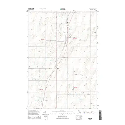
2014 Map of Nadeau
USGS Topo · Published 2014About this map
Nadeau and Carney serve as central points in this portion of Menominee County, situated along a north-south transit corridor defined by US-41 and the parallel rail line. The landscape is structured by a rigorous township and range grid, where rural roads like 34 Mile Rd and Seven Hill Rd provide access to interior woodlots and fields. The Little Cedar River and its various tributaries, including Laurin Cr, Holmes Cr, and Schetter Cr, drain the region toward the south, occasionally widening into features like Talbot Pond. Local history is anchored by several distinct burial grounds, such as the Swedish Cem and Calvary Cem, which reflect the community's heritage. The southern boundary of the map includes the small settlement of Talbot and DeGroote Lake, while numerous small streams like Hays Cr and Boyle Cr weave through the terrain.
Find a feature on this map
52 named features on this map. Tap any name to fly to it.
Don’t see what you’re looking for? This feature index may not catch every label — zoom into the map to look around manually.
Map Details
Editions of this 2014 Nadeau Map
This is the sole edition of this map. No revisions or reprints were ever made.
Other maps of this area

1949 · Stephenson
USGS Topo · 1:48,000

1954 · Escanaba
USGS Topo · 1:250,000

1957 · Escanaba
USGS Topo · 1:250,000

1958 · Escanaba
USGS Topo · 1:250,000

1963 · Bark River
USGS Topo · 1:62,500

1963 · Powers
USGS Topo · 1:62,500

1963 · Cedar River
USGS Topo · 1:62,500

1963 · Stephenson
USGS Topo · 1:62,500

1981 · Marinette
USGS Topo · 1:100,000

1982 · Escanaba
USGS Topo · 1:100,000