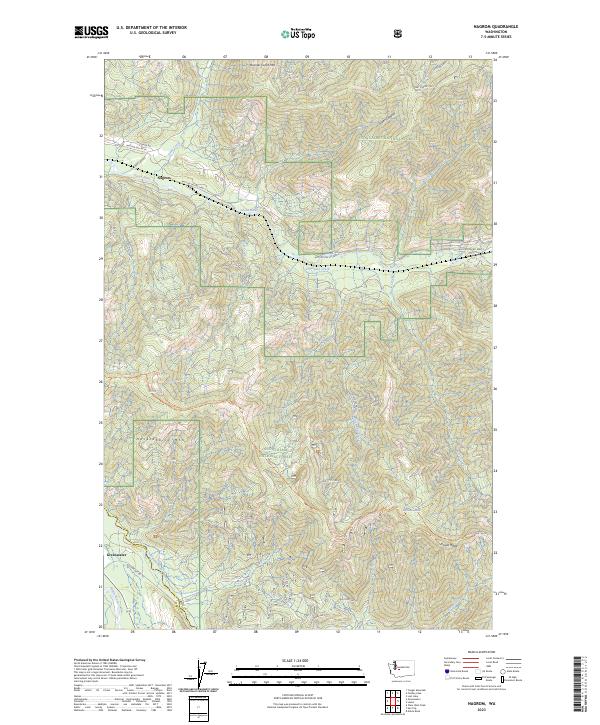
2023 Map of Nagrom
USGS Topo · Published 2023About this map
Nagrom and the high ridge country of the Snoqualmie National Forest define this landscape along the upper reaches of the Green River. The topography is dominated by massive landforms such as Rooster Comb Mtn and Huckleberry Mtn, where elevations rise sharply from the river valleys. A network of forest development roads, including Nat For Dev Rd 5400-3 and NFD 7010 Rd, snakes through the steep terrain, tracing the routes of timber management and mountain access. In the southern portion of the quadrangle, the Greenwater River and White River converge near the settlement of Greenwater, marking a significant drainage divide at the border of King and Pierce counties. The map captures the specialized geography of the Cascades, where features like Divide Ridge and the Divide Trl separate major watersheds amidst a dense system of creeks like Smay Creek and Wolf Creek.
Find a feature on this map
45 named features on this map. Tap any name to fly to it.
Don’t see what you’re looking for? This feature index may not catch every label — zoom into the map to look around manually.
Map Details
Editions of this 2023 Nagrom Map
This is the sole edition of this map. No revisions or reprints were ever made.
Other maps of this area

1901 · Snoqualmie Pass
USGS Topo · 1:125,000

1903 · Snoqualmie
USGS Topo · 1:125,000

1913 · Cedar Lake
USGS Topo · 1:125,000

1956 · Greenwater
USGS Topo · 1:62,500

1957 · Wenatchee
USGS Topo · 1:250,000

1960 · Bandera
USGS Topo · 1:62,500

1961 · Snoqualmie Pass
USGS Topo · 1:62,500

1962 · Lester
USGS Topo · 1:62,500

1975 · Snoqualmie Pass
USGS Topo · 1:100,000
1986 · Nagrom
USGS Topo · 1:24,000