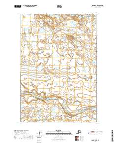
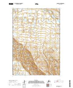
2019 Map of Naknek B-3 SE
USGS Topo · Published 2019About this map
King Salmon River meanders across the southern reaches of this landscape, its winding channel defining the low-lying terrain of the Alaska Peninsula. This 2019 survey, part of the U.S. Geological Survey modernization, documents a wilderness area largely defined by its natural hydrology and the established township and range grids. The map is organized by the Public Land Survey System boundaries of t21s r46w, t21s r45w, t22s r46w, and t22s r45w. In this part of the Lake and Peninsula Borough, the lack of road infrastructure or named settlements emphasizes the purely topographical and hydrographical nature of the region, where the primary landmark remains the braided path of the river itself.
Find a feature on this map
5 named features on this map. Tap any name to fly to it.
Don’t see what you’re looking for? This feature index may not catch every label — zoom into the map to look around manually.
Map Details
Editions of this 2019 Naknek B-3 SE Map
This is the sole edition of this map. No revisions or reprints were ever made.
Other maps of this area

1951 · Naknek A-2
USGS Topo · 1:63,360

1951 · Naknek A-3
USGS Topo · 1:63,360

1952 · Naknek
USGS Topo · 1:250,000

1952 · Naknek B-3
USGS Topo · 1:63,360

1952 · Naknek B-2
USGS Topo · 1:63,360

1964 · Naknek
USGS Topo · 1:250,000
2019 · Naknek B-3 NE
USGS Topo · 1:25,000
2019 · Naknek A-3 NE
USGS Topo · 1:25,000
2019 · Naknek B-3 NW
USGS Topo · 1:25,000
2019 · Naknek A-2 NW
USGS Topo · 1:25,000