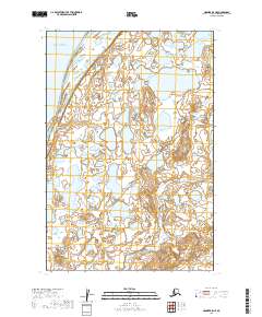
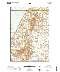
2019 Map of Naknek B-5 NE
USGS Topo · Published 2019About this map
Kvichak Bay dominates the northwest corner of this coastal landscape in the Lake and Peninsula Borough. The terrain is defined by a dense network of small ponds and unnamed water bodies typical of this Alaskan tundra region. In the eastern half of the map, Big Creek winds southward through the low-lying wetlands, eventually crossing through Township 20 South and into Township 21 South. This 2019 survey, produced by the U.S. Geological Survey using data from 1899 through 2018, offers a clear view of the natural drainage patterns and topographical contours at the edge of the bay. The lack of named roads or settlements highlights the isolation of this environment, where the shifting hydrology of Big Creek and the tidal influence of the bay are the primary landmarks for navigators and researchers.
Find a feature on this map
8 named features on this map. Tap any name to fly to it.
Don’t see what you’re looking for? This feature index may not catch every label — zoom into the map to look around manually.
Map Details
Editions of this 2019 Naknek B-5 NE Map
This is the sole edition of this map. No revisions or reprints were ever made.
Other maps of this area

1952 · Naknek
USGS Topo · 1:250,000

1952 · Naknek C-5
USGS Topo · 1:63,360

1952 · Naknek B-4
USGS Topo · 1:63,360

1952 · Naknek B-5
USGS Topo · 1:63,360

1952 · Naknek C-4
USGS Topo · 1:63,360

1964 · Naknek
USGS Topo · 1:250,000
2019 · Naknek B-4 NW
USGS Topo · 1:25,000
2019 · Naknek B-5 NW
USGS Topo · 1:25,000
2019 · Naknek B-4 SW
USGS Topo · 1:25,000
2019 · Naknek C-4 SW
USGS Topo · 1:25,000