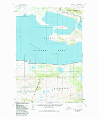
1951 Map of Naknek C-1
USGS Topo · Published 1984About this map
Naknek Lake dominates this 1951 topographic study, which captures the interior of the Alaska Peninsula during a period of transition in federal land management. The expanse of the Naknek Lake (North Arm) is depicted alongside the southern boundaries of the Katmai Wilderness, an area that would later see its status codified under the Alaska National Interest Lands Conservation Act. The map reveals a landscape defined by water and administrative borders, including the line for the Bristol Bay Borough and the Becharof National Wildlife Refuge. While the terrain is absent of roads or permanent settlements in this era, the survey establishes the critical relationship between Katmai National Park and the surrounding protected wilderness areas. This edition, featuring revisions from 1983, serves as a record of the region's geography before modern infrastructure or increased human activity altered the peninsula's wild character.
Find a feature on this map
7 named features on this map. Tap any name to fly to it.
Don’t see what you’re looking for? This feature index may not catch every label — zoom into the map to look around manually.
Map Details
Editions of this 1951 Naknek C-1 Map
3 editions found
Other maps of this area

1948 · Mt Katmai
USGS Topo · 1:250,000

1951 · Mt Katmai
USGS Topo · 1:250,000

1951 · Mount Katmai C-6
USGS Topo · 1:63,360

1951 · Mount Katmai B-6
USGS Topo · 1:63,360

1951 · Naknek D-1
USGS Topo · 1:63,360

1951 · Naknek B-1
USGS Topo · 1:63,360

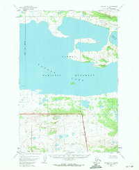
1951 · Naknek C-1
USGS Topo · 1:63,360

1951 · Mount Katmai D-6
USGS Topo · 1:63,360

1952 · Naknek
USGS Topo · 1:250,000

1952 · Naknek D-2
USGS Topo · 1:63,360