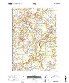
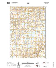
2019 Map of Naknek C-3 NE
USGS Topo · Published 2019About this map
The Naknek River snakes through the heart of this Bristol Bay region, defining a landscape of wetlands and low-lying points. Along its northern banks, a network of residential and service roads such as Grizzly Bear Street, Wolverine Drive, and Thelma Drive branch off from the primary Naknek/King Salmon (AK Pen Hwy) Road. This area shows the concentrated development near the river's path, including local landmarks like the Bear Trail Lodge.
Find a feature on this map
42 named features on this map. Tap any name to fly to it.
Don’t see what you’re looking for? This feature index may not catch every label — zoom into the map to look around manually.
Map Details
Editions of this 2019 Naknek C-3 NE Map
This is the sole edition of this map. No revisions or reprints were ever made.
Other maps of this area

1952 · Naknek
USGS Topo · 1:250,000

1952 · Naknek D-2
USGS Topo · 1:63,360

1952 · Naknek C-2
USGS Topo · 1:63,360

1952 · Naknek C-3
USGS Topo · 1:63,360

1952 · Naknek D-3
USGS Topo · 1:63,360

1964 · Naknek
USGS Topo · 1:250,000
2019 · Naknek C-2 SW
USGS Topo · 1:25,000
2019 · Naknek C-3 NW
USGS Topo · 1:25,000
2019 · Naknek C-2 NW
USGS Topo · 1:25,000
2019 · Naknek D-3 SE
USGS Topo · 1:25,000