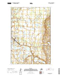
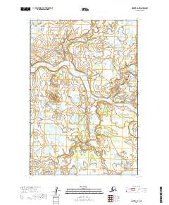
2019 Map of Naknek C-2 NW
USGS Topo · Published 2019About this map
The Naknek River dominates the landscape south of the King Salmon Airport, flowing past Grassy Point and Mushevik Point toward The Lower Lagoon. This coastal region of Bristol Bay serves as a critical junction for aviation and wilderness access, with the airport facilities and various local roads like Lake Camp Road and Paradise Point Road facilitating movement between the water and the interior.
Find a feature on this map
27 named features on this map. Tap any name to fly to it.
Don’t see what you’re looking for? This feature index may not catch every label — zoom into the map to look around manually.
Map Details
Editions of this 2019 Naknek C-2 NW Map
This is the sole edition of this map. No revisions or reprints were ever made.
Other maps of this area

1952 · Naknek
USGS Topo · 1:250,000

1952 · Naknek D-2
USGS Topo · 1:63,360

1952 · Naknek C-2
USGS Topo · 1:63,360

1952 · Naknek C-3
USGS Topo · 1:63,360

1952 · Naknek D-3
USGS Topo · 1:63,360

1964 · Naknek
USGS Topo · 1:250,000
2019 · Naknek C-2 SW
USGS Topo · 1:25,000
2019 · Naknek D-2 SE
USGS Topo · 1:25,000
2019 · Naknek C-2 SE
USGS Topo · 1:25,000
2019 · Naknek C-3 NE
USGS Topo · 1:25,000