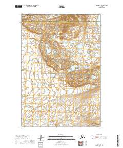
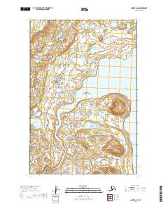
2019 Map of Naknek C-2 SE
USGS Topo · Published 2019About this map
Katmai National Park and the Becharof National Wildlife Refuge dominate this landscape, meeting along a boundary that divides two major Alaskan conservation areas. The terrain is defined by the transition from the hydrologic systems of Naknek Lake in the northeast to the sprawling wetlands and small ponds that characterize the southern refuge lands. In the northwest corner, the Naknek River begins its course, serving as a critical waterway for the region's ecology and the administrative border between the Bristol Bay Borough and Lake and Peninsula Borough. The map illustrates a wilderness largely devoid of human infrastructure, where the natural drainage patterns and glacial landforms dictate the geography. Researchers can observe the intricate network of unnamed ponds and marshes that fill the lowlands between the protected park and wildlife refuge areas.
Find a feature on this map
10 named features on this map. Tap any name to fly to it.
Don’t see what you’re looking for? This feature index may not catch every label — zoom into the map to look around manually.
Map Details
Editions of this 2019 Naknek C-2 SE Map
This is the sole edition of this map. No revisions or reprints were ever made.
Other maps of this area

1951 · Naknek B-1
USGS Topo · 1:63,360

1951 · Naknek C-1
USGS Topo · 1:63,360

1952 · Naknek
USGS Topo · 1:250,000

1952 · Naknek B-2
USGS Topo · 1:63,360

1952 · Naknek C-2
USGS Topo · 1:63,360

1964 · Naknek
USGS Topo · 1:250,000
2019 · Naknek C-2 SW
USGS Topo · 1:25,000
2019 · Naknek C-2 NW
USGS Topo · 1:25,000
2019 · Naknek C-1 SW
USGS Topo · 1:25,000
2019 · Naknek C-2 NE
USGS Topo · 1:25,000