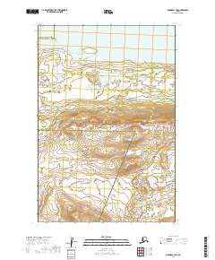
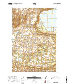
2019 Map of Naknek C-1 SW
USGS Topo · Published 2019About this map
Naknek Lake dominates the northern reaches of this Alaskan wilderness, marking the threshold of a landscape defined by significant protected conservation areas. To the east lies the boundary of Katmai National Park, while the southern expanse transitions into the Becharof National Wildlife Refuge. This map illustrates a remote intersection of administrative and natural boundaries, specifically where the Bristol Bay Borough Lake and Peninsula Borough line meets these federal lands. The terrain is characterized by a dense network of water bodies and dramatic elevation changes, reflecting the pristine state of the Alaska Peninsula's interior during the early twenty-first century.
Find a feature on this map
8 named features on this map. Tap any name to fly to it.
Don’t see what you’re looking for? This feature index may not catch every label — zoom into the map to look around manually.
Map Details
Editions of this 2019 Naknek C-1 SW Map
This is the sole edition of this map. No revisions or reprints were ever made.
Other maps of this area

1951 · Naknek B-1
USGS Topo · 1:63,360

1951 · Naknek C-1
USGS Topo · 1:63,360

1952 · Naknek
USGS Topo · 1:250,000

1952 · Naknek B-2
USGS Topo · 1:63,360

1952 · Naknek C-2
USGS Topo · 1:63,360

1964 · Naknek
USGS Topo · 1:250,000
2019 · Naknek C-2 SE
USGS Topo · 1:25,000
2019 · Naknek C-1 NE
USGS Topo · 1:25,000
2019 · Naknek C-2 NE
USGS Topo · 1:25,000
2019 · Naknek B-1 NE
USGS Topo · 1:25,000