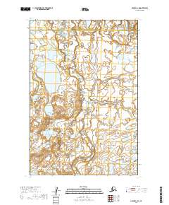
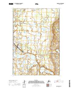
2019 Map of Naknek C-2 SW
USGS Topo · Published 2019About this map
Naknek River flows through the northern reaches of this coastal Alaskan landscape, marking a transition between protected federal lands. The northeastern corner of the map is defined by the boundary of Katmai National Park, while the southern portion transitions into the Becharof National Wildlife Refuge. This intersection of conservation areas highlights the region's importance as a wilderness corridor within the Lake and Peninsula Borough. The terrain is characterized by an extensive network of wetlands and small water bodies typical of the Bristol Bay lowlands, showing the intricate hydrology that supports the local ecosystem before it reaches the sea.
Find a feature on this map
8 named features on this map. Tap any name to fly to it.
Don’t see what you’re looking for? This feature index may not catch every label — zoom into the map to look around manually.
Map Details
Editions of this 2019 Naknek C-2 SW Map
This is the sole edition of this map. No revisions or reprints were ever made.
Other maps of this area

1952 · Naknek
USGS Topo · 1:250,000

1952 · Naknek B-3
USGS Topo · 1:63,360

1952 · Naknek B-2
USGS Topo · 1:63,360

1952 · Naknek C-2
USGS Topo · 1:63,360

1952 · Naknek C-3
USGS Topo · 1:63,360

1964 · Naknek
USGS Topo · 1:250,000
2019 · Naknek B-3 NE
USGS Topo · 1:25,000
2019 · Naknek C-2 SE
USGS Topo · 1:25,000
2019 · Naknek C-3 NE
USGS Topo · 1:25,000
2019 · Naknek C-2 NW
USGS Topo · 1:25,000