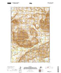
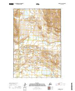
2019 Map of Naknek D-2 SE
USGS Topo · Published 2019About this map
Katmai National Park encompasses the southern portion of this landscape, marking a transition from the rolling interior hills to the protected wilderness of the Alaska Peninsula. The terrain is defined by the winding paths of Pauls Cr in the north and King Salmon Cr which cuts across the central and western sections. These drainage patterns suggest a remote, undeveloped region where the hydrography dictates the natural corridors of the land. The absence of roads or permanent settlements in this 2019 survey highlights the untouched character of the Bristol Bay Borough interior, preserved within the federal park system and the surrounding public land survey sections.
Find a feature on this map
7 named features on this map. Tap any name to fly to it.
Don’t see what you’re looking for? This feature index may not catch every label — zoom into the map to look around manually.
Map Details
Editions of this 2019 Naknek D-2 SE Map
This is the sole edition of this map. No revisions or reprints were ever made.
Other maps of this area

1951 · Naknek D-1
USGS Topo · 1:63,360

1951 · Naknek C-1
USGS Topo · 1:63,360

1952 · Naknek
USGS Topo · 1:250,000

1952 · Naknek D-2
USGS Topo · 1:63,360

1952 · Naknek C-2
USGS Topo · 1:63,360

1964 · Naknek
USGS Topo · 1:250,000
2019 · Naknek D-2 NW
USGS Topo · 1:25,000
2019 · Naknek C-2 NW
USGS Topo · 1:25,000
2019 · Naknek D-1 NW
USGS Topo · 1:25,000
2019 · Naknek D-1 SW
USGS Topo · 1:25,000