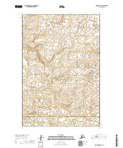
2019 Map of Naknek D-2 NW
USGS Topo · Published 2019About this map
Lake and Peninsula Borough and Bristol Bay Borough meet in this 2019 survey of south-central Alaska. The landscape is defined by a dense network of unnamed small lakes and ponds typical of the Bristol Bay drainage. Coffee Cr meanders across the central and southern sections, providing a primary drainage feature through the level, water-heavy terrain. This USGS topographic study illustrates the intricate hydrography of the region during the early 21st century, showing how water dominates the land surface with hundreds of small basins. Aside from the established township and range boundaries like t14s r44w, the area is devoid of major human infrastructure or settlements, reflecting its status as part of the vast Alaskan wilderness near the Alaska Peninsula.
Find a feature on this map
7 named features on this map. Tap any name to fly to it.
Don’t see what you’re looking for? This feature index may not catch every label — zoom into the map to look around manually.
Map Details
Editions of this 2019 Naknek D-2 NW Map
This is the sole edition of this map. No revisions or reprints were ever made.
Other maps of this area

1951 · Dillingham
USGS Topo · 1:250,000

1952 · Naknek
USGS Topo · 1:250,000

1952 · Dillingham A-2
USGS Topo · 1:63,360

1952 · Naknek D-2
USGS Topo · 1:63,360

1952 · Naknek D-3
USGS Topo · 1:63,360

1954 · Dillingham
USGS Topo · 1:250,000

1964 · Naknek
USGS Topo · 1:250,000
2019 · Naknek D-2 SE
USGS Topo · 1:25,000
2019 · Dillingham A-2 SE
USGS Topo · 1:25,000
2019 · Dillingham A-2 SW
USGS Topo · 1:25,000