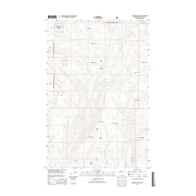
2014 Map of Naneum Canyon
USGS Topo · Published 2014About this map
The Wenatchee National Forest dominates this high-altitude landscape in Kittitas County, defined by a complex network of deep drainages and flat-topped ridges. Water sources are critical markers in this terrain, including the isolated Leonard Spring and Gustafson Spring, which provide essential moisture for the local ecosystem. Central to the geography is the Naneum Canyon and its associated Naneum Basin, where Naneum Creek carves through the volcanic geology. The presence of several "flats," such as Croker Flat and Walter Flat, suggests areas of slightly more level ground amidst the steep descents into Schnebly Canyon, Dawson Canyon, and Cave Canyon. Historic transit is represented by routes like the Teanaway Wilson Stock Trail, a name that points to the region's legacy of livestock movement between seasonal pastures.
Find a feature on this map
35 named features on this map. Tap any name to fly to it.
Don’t see what you’re looking for? This feature index may not catch every label — zoom into the map to look around manually.
Map Details
Editions of this 2014 Naneum Canyon Map
This is the sole edition of this map. No revisions or reprints were ever made.
Other maps of this area

1897 · Mount Stuart
USGS Topo · 1:125,000

1902 · Mount Stuart
USGS Topo · 1:125,000

1913 · Wenatchee
USGS Topo · 1:62,500

1915 · Wenatchee
USGS Topo · 1:62,500

1920 · Colockum Pass
USGS Topo · 1:125,000

1922 · Colockum Pass
USGS Topo · 1:125,000

1957 · Wenatchee
USGS Topo · 1:250,000

1958 · Thorp
USGS Topo · 1:62,500
1958 · Ellensburg North
USGS Topo · 1:24,000

1961 · Liberty
USGS Topo · 1:62,500