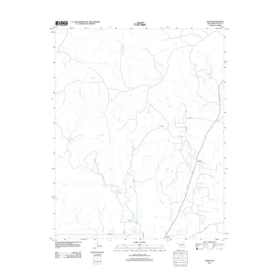
2012 Map of Nanos
USGS Topo · Published 2012About this map
The Pappin Cem remains a central landmark in this portion of Osage County, situated just north of the small community of Opah. The landscape is defined by an intricate network of waterways draining the Oklahoma territory, including the winding Wild Hog Cr and Mud Cr. These streams converge toward the southern boundary near Sand Cr, illustrating the natural drainage patterns of the region before they reach larger reservoirs downstream.
Find a feature on this map
21 named features on this map. Tap any name to fly to it.
Don’t see what you’re looking for? This feature index may not catch every label — zoom into the map to look around manually.
Map Details
Editions of this 2012 Nanos Map
This is the sole edition of this map. No revisions or reprints were ever made.
Other maps of this area

1906 · Nelagoney
USGS Topo · 1:24,000

1909 · Pawhuska
USGS Topo · 1:125,000

1910 · Pawhuska
USGS Topo · 1:125,000

1955 · Enid
USGS Topo · 1:250,000

1958 · Enid
USGS Topo · 1:250,000

1960 · Nanos
USGS Topo · 1:24,000

1960 · Nelagoney
USGS Topo · 1:24,000

1960 · Herd
USGS Topo · 1:24,000

1960 · Pawhuska
USGS Topo · 1:24,000
1973 · Pearsonia
USGS Topo · 1:24,000