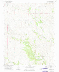
1973 Map of Pearsonia
USGS Topo · Published 1975About this map
Pearsonia lies at the heart of this landscape within the Osage Indian Reservation, a region shaped by the intersection of early Oklahoma ranching and energy extraction. The map documents an extensive Oil Field and a network of pipelines that cut across the undulating terrain, interspersed with Numerous oil wells. Evidence of former transportation networks is visible via the Old RR Grade in the northwestern corner, indicating the shifting infrastructure of the early 20th century.
Find a feature on this map
17 named features on this map. Tap any name to fly to it.
Don’t see what you’re looking for? This feature index may not catch every label — zoom into the map to look around manually.
Map Details
Editions of this 1973 Pearsonia Map
This is the sole edition of this map. No revisions or reprints were ever made.
Other maps of this area

1909 · Pawhuska
USGS Topo · 1:125,000

1910 · Pawhuska
USGS Topo · 1:125,000

1916 · Foraker
USGS Topo · 1:62,500

1932 · Fairfax
USGS Topo · 1:62,500

1955 · Enid
USGS Topo · 1:250,000

1958 · Enid
USGS Topo · 1:250,000

1960 · Nanos
USGS Topo · 1:24,000

1960 · Pawhuska
USGS Topo · 1:24,000
1973 · Pearsonia NE
USGS Topo · 1:24,000
1973 · Bluestem Lake
USGS Topo · 1:24,000