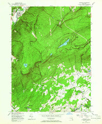
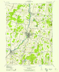
1956 Map of Napanoch
USGS Topo · Published 1966About this map
The Shawangunk Mountains dominate this 1956 landscape, creating a dramatic physical divide between the valley settlements of Napanoch and Walker Valley. High-altitude landmarks like Lake Maratanza and Awosting Lake sit atop the ridge, flanked by sheer features such as Sams Point and Castle Point. This era shows the region's diverse land use, from the State Institution for Male Defective Delinquents near East Wawarsing to recreational sites like Camp Laurel and the Quannacut Y W C A Camp.
Find a feature on this map
55 named features on this map. Tap any name to fly to it.
Don’t see what you’re looking for? This feature index may not catch every label — zoom into the map to look around manually.
Map Details
Editions of this 1956 Napanoch Map
4 editions found
Other maps of this area

1901 · Rosendale
USGS Topo · 1:62,500

1903 · Newburg
USGS Topo · 1:62,500

1903 · Rosendale
USGS Topo · 1:62,500

1903 · Slide Mountain
USGS Topo · 1:62,500

1904 · Ellenville
USGS Topo · 1:62,500

1905 · Slide Mountain
USGS Topo · 1:62,500

1906 · Ellenville
USGS Topo · 1:62,500
1942 · Walden
USGS Topo · 1:24,000

1942 · Lackawack
USGS Topo · 1:24,000

1942 · Kerhonkson
USGS Topo · 1:24,000