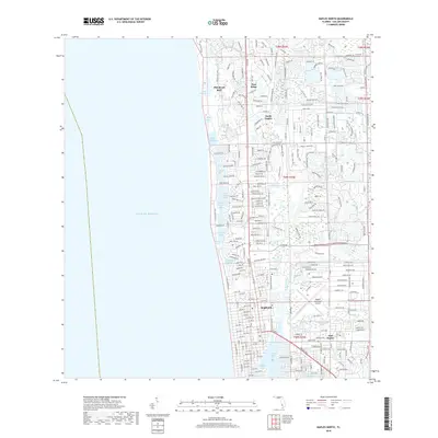
2018 Map of Naples North
USGS Topo · Published 2018About this map
The Gulf Coast city of Naples and its surrounding coastal communities are shown in high detail at the end of the 2010s. The landscape is defined by its complex network of interconnected waterways and residential developments, including Pelican Bay, Pine Ridge, and North Naples. Significant coastal features such as Doctors Pass and Hurricane Harbor demonstrate the area's intricate shoreline, while the inland is bisected by the Gordon River and Rock Creek. The eastern portion of the map is anchored by the Naples Municipal Airport, reflecting the region's modern infrastructure and transport hubs. Further south, the map details the waterfront around Crayton Cove and the northern reaches of Naples Bay, illustrating the transition into East Naples. This recent survey provides a precise account of the modern street grids and water-management systems that shaped the city's late-twentieth and early-twenty-first-century expansion.
Find a feature on this map
267 named features on this map. Tap any name to fly to it.
Don’t see what you’re looking for? This feature index may not catch every label — zoom into the map to look around manually.
Map Details
Editions of this 2018 Naples North Map
This is the sole edition of this map. No revisions or reprints were ever made.
Other maps of this area

1956 · West Palm Beach
USGS Topo · 1:250,000

1957 · West Palm Beach
USGS Topo · 1:250,000

1958 · West Palm Beach
USGS Topo · 1:250,000

1958 · Bonita Springs
USGS Topo · 1:24,000

1958 · Belle Meade
USGS Topo · 1:24,000

1958 · Naples South
USGS Topo · 1:24,000

1958 · Belle Meade NW
USGS Topo · 1:24,000

1958 · Corkscrew SW
USGS Topo · 1:24,000

1958 · Naples North
USGS Topo · 1:24,000
1985 · Naples
USGS Topo · 1:100,000