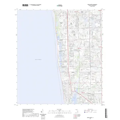
2024 Map of Naples North
USGS Topo · Published 2024About this map
The Gulf of Mexico shoreline defines this coastal reach, where a sophisticated network of inland waterways and residential developments shapes the landscape. From the northern extent at Pelican Bay down through the primary city of Naples, the map details a complex system of lagoons and passes including Outer Clam Bay, Venetian Bay, and Moorings Bay. The presence of numerous memorial garden cemeteries, such as the Saint John Episcopal Church Memorial Garden Cem and Faith Lutheran Church Memorial Garden Cem, highlights the community's established local history and religious infrastructure.
Find a feature on this map
48 named features on this map. Tap any name to fly to it.
Don’t see what you’re looking for? This feature index may not catch every label — zoom into the map to look around manually.
Map Details
Editions of this 2024 Naples North Map
This is the sole edition of this map. No revisions or reprints were ever made.
Other maps of this area

1956 · West Palm Beach
USGS Topo · 1:250,000

1957 · West Palm Beach
USGS Topo · 1:250,000

1958 · West Palm Beach
USGS Topo · 1:250,000

1958 · Bonita Springs
USGS Topo · 1:24,000

1958 · Belle Meade
USGS Topo · 1:24,000

1958 · Naples South
USGS Topo · 1:24,000

1958 · Belle Meade NW
USGS Topo · 1:24,000

1958 · Corkscrew SW
USGS Topo · 1:24,000

1958 · Naples North
USGS Topo · 1:24,000
1985 · Naples
USGS Topo · 1:100,000