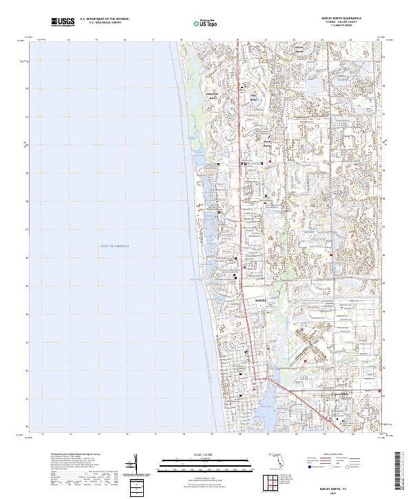
2025 Map of Naples North
USGS Topo · Published 2025About this map
The coastal transition of Southwest Florida is documented here, showing the dense network of residential developments and inland waterways along the Gulf of America. From Pelican Marsh and Pelican Bay in the north down to Naples and East Naples, the landscape is defined by its maritime orientation. The intricate system of lagoons and passes, including Venetian Bay, Moorings Bay, and Clam Pass, illustrates the area's modern shoreline character. Significant civic infrastructure is clustered in the south, including the Naples Municipal Airport and the Collier County Courthouse near Haldeman Creek. Unique to this coastal stretch is the concentration of specialized memorial sites such as the Covenant Memorial Gardens and the North Naples United Methodist Church Columbarium, which are integrated into the community layout alongside major thoroughfares like the Tamiami Trl.
Find a feature on this map
40 named features on this map. Tap any name to fly to it.
Don’t see what you’re looking for? This feature index may not catch every label — zoom into the map to look around manually.
Map Details
Editions of this 2025 Naples North Map
This is the sole edition of this map. No revisions or reprints were ever made.
Other maps of this area

1956 · West Palm Beach
USGS Topo · 1:250,000

1957 · West Palm Beach
USGS Topo · 1:250,000

1958 · West Palm Beach
USGS Topo · 1:250,000

1958 · Bonita Springs
USGS Topo · 1:24,000

1958 · Belle Meade
USGS Topo · 1:24,000

1958 · Naples South
USGS Topo · 1:24,000

1958 · Belle Meade NW
USGS Topo · 1:24,000

1958 · Corkscrew SW
USGS Topo · 1:24,000

1958 · Naples North
USGS Topo · 1:24,000
1985 · Naples
USGS Topo · 1:100,000