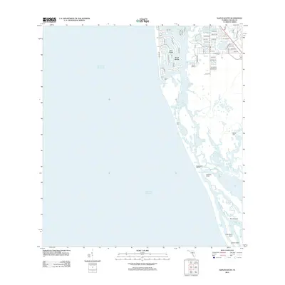
2012 Map of Naples South
USGS Topo · Published 2012About this map
Port Royal and Royal Harbor anchor the developed northern reach of this coastline, where a intricate network of residential streets and man-made canals meets Naples Bay. The 2012 landscape transitions quickly from these groomed harbors into the wilder, estuarine environment of the Ten Thousand Islands region. South of Gordon Pass, the map reveals a complex system of barrier islands and tidal waterways, including Keewaydin Island and Dollar Bay. These areas, characterized by features like Johns Pass and Bartell Bay, demonstrate the natural geomorphology of the Florida Gulf Coast. Navigational points such as the Kokomis Ferry and various marinas like Gulf Shores Marina highlight the area's maritime focus, while southern landmarks like Little Marco Island and Cannon Island remain largely shaped by tidal forces and mangrove systems.
Find a feature on this map
63 named features on this map. Tap any name to fly to it.
Don’t see what you’re looking for? This feature index may not catch every label — zoom into the map to look around manually.
Map Details
Editions of this 2012 Naples South Map
This is the sole edition of this map. No revisions or reprints were ever made.
Other maps of this area

1956 · Miami
USGS Topo · 1:250,000

1956 · West Palm Beach
USGS Topo · 1:250,000

1957 · West Palm Beach
USGS Topo · 1:250,000

1958 · West Palm Beach
USGS Topo · 1:250,000

1958 · Miami
USGS Topo · 1:250,000

1958 · Belle Meade
USGS Topo · 1:24,000

1958 · Naples South
USGS Topo · 1:24,000

1958 · Belle Meade NW
USGS Topo · 1:24,000

1958 · Naples North
USGS Topo · 1:24,000

1973 · Marco Island
USGS Topo · 1:24,000