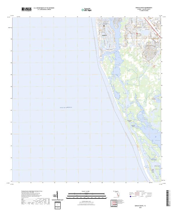
2025 Map of Naples South
USGS Topo · Published 2025About this map
Naples sits at the northern edge of a complex network of barrier islands and mangrove-fringed waterways, where the coastal developments of the city meet the protected reaches of the southwest Florida shoreline. The neighborhood layout near Naples Bay is defined by intricate finger canals and named streets such as Gin Ln, Rum Row, and Admiralty Parade, reflecting a high degree of modern residential planning around the waterfront. Just south of Gordon Pass, the landscape transitions into a more natural state, dominated by the linear stretch of Keewaydin Island and the tidal channels of Rookery Bay. Local history and community roots are anchored at the Trinity By The Cove Episcopal Church and the adjacent Trinity By The Cove Episcopal Church Cem. The map also captures the extensive Florida Circumnavigational Paddling Trail T11 as it threads through the backwaters of Dollar Bay and Bartell Bay.
Find a feature on this map
66 named features on this map. Tap any name to fly to it.
Don’t see what you’re looking for? This feature index may not catch every label — zoom into the map to look around manually.
Map Details
Editions of this 2025 Naples South Map
This is the sole edition of this map. No revisions or reprints were ever made.
Other maps of this area

1956 · Miami
USGS Topo · 1:250,000

1956 · West Palm Beach
USGS Topo · 1:250,000

1957 · West Palm Beach
USGS Topo · 1:250,000

1958 · West Palm Beach
USGS Topo · 1:250,000

1958 · Miami
USGS Topo · 1:250,000

1958 · Belle Meade
USGS Topo · 1:24,000

1958 · Naples South
USGS Topo · 1:24,000

1958 · Belle Meade NW
USGS Topo · 1:24,000

1958 · Naples North
USGS Topo · 1:24,000

1973 · Marco Island
USGS Topo · 1:24,000