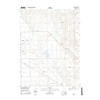
2014 Map of Naples
USGS Topo · Published 2014About this map
Naples and the eastern edge of Vernal anchor this 2014 survey of the Uintah Basin, where the high desert landscape is defined by its water management and agricultural infrastructure. The topography is marked by a series of engineered water bodies, including Bullwinkle Reservoir, Burns Bench Reservoir, and Herman-Sadlier Reservoir, which serve the arid plateaus and benches above the drainage of Ashley Cr. This network of reservoirs and canals supports the agricultural life of the basin, contrasting with the nearby dry terrain of the Buckskin Hills and the Sunshine Bench. The map captures the interface between the growing residential areas of Naples and the expansive, sectioned land of the Public Land Survey System. Strategic transportation corridors like Us-40 cut through the landscape, connecting these desert communities while smaller routes such as N Sunshine Bench Rd and S Brush Creek Rd provide access to the outlying draws and gulches.
Find a feature on this map
53 named features on this map. Tap any name to fly to it.
Don’t see what you’re looking for? This feature index may not catch every label — zoom into the map to look around manually.
Map Details
Editions of this 2014 Naples Map
This is the sole edition of this map. No revisions or reprints were ever made.
Other maps of this area

1885 · Ashley
USGS Topo · 1:250,000

1906 · Marsh Peak
USGS Topo · 1:125,000

1907 · Jensen
USGS Topo · 1:125,000

1908 · Marsh Peak
USGS Topo · 1:125,000

1910 · Jensen
USGS Topo · 1:125,000

1917 · Vernal
USGS Topo · 1:125,000

1954 · Vernal
USGS Topo · 1:250,000

1958 · Vernal
USGS Topo · 1:250,000

1960 · Vernal
USGS Topo · 1:250,000

1964 · Vernal NE
USGS Topo · 1:24,000