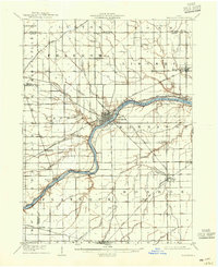
1908 Map of Napoleon
USGS Topo · Published 1942About this map
The Maumee River corridor serves as the primary axis of development in this early 20th-century landscape, where the town of Napoleon sits at a critical junction of river traffic and regional rail lines. The presence of the Miami and Erie Canal running parallel to the river on its northern bank reveals the lingering infrastructure of 19th-century water transport alongside the modernizing influence of the Wabash RR. Beyond the river valley, the terrain is defined by an extensive network of drainage ditches such as Konzen Ditch and Brinkman Ditch, which converted the region's heavy soils into productive farmland.
Find a feature on this map
40 named features on this map. Tap any name to fly to it.
Don’t see what you’re looking for? This feature index may not catch every label — zoom into the map to look around manually.
Map Details
Editions of this 1908 Napoleon Map
2 editions found
Other maps of this area

1907 · Defiance
USGS Topo · 1:62,500

1908 · Ottawa
USGS Topo · 1:62,500

1908 · Napoleon
USGS Topo · 1:62,500

1909 · Mc Clure
USGS Topo · 1:62,500

1909 · Defiance
USGS Topo · 1:62,500

1909 · Continental
USGS Topo · 1:62,500

1911 · Wauseon
USGS Topo · 1:62,500

1911 · Swanton
USGS Topo · 1:62,500

1913 · Wauseon
USGS Topo · 1:62,500

1913 · Alvordton
USGS Topo · 1:62,500