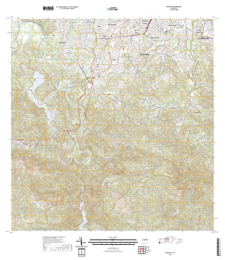
2024 Map of Naranjito
USGS Topo · Published 2024About this map
Naranjito and the surrounding municipalities of Bayamón and Guaynabo anchor this contemporary survey of the island's central-northern interior. The landscape is defined by the deep incision of the Río de la Plata and its numerous tributaries, including Quebrada La Concha and Quebrada Anones, which carve through the steep terrain toward the northern coast. Modern residential developments like Royal Town and Flamingo Garden sit alongside established barrios, reflecting the region's dense urban-rural interface.
Find a feature on this map
76 named features on this map. Tap any name to fly to it.
Don’t see what you’re looking for? This feature index may not catch every label — zoom into the map to look around manually.
Map Details
Editions of this 2024 Naranjito Map
This is the sole edition of this map. No revisions or reprints were ever made.
Other maps of this area

1940 · Vega Alta
USGS Topo · 1:30,000

1941 · Bayamon
USGS Topo · 1:30,000

1941 · San Juan
USGS Topo · 1:30,000

1946 · Aguas Buenas
USGS Topo · 1:30,000

1946 · Corozal
USGS Topo · 1:30,000

1946 · Barranquitas
USGS Topo · 1:30,000

1946 · Vega Alta
USGS Topo · 1:30,000

1946 · Comerio
USGS Topo · 1:30,000

1946 · Naranjito
USGS Topo · 1:30,000

1946 · Caguas
USGS Topo · 1:30,000
Featured Places
- Naranjito
- Villas del Olimpo, Bayamón
- Sector María López, Bayamón
- Sector Pellín Ortega, Bayamón
- Villa Embrolla, Naranjito