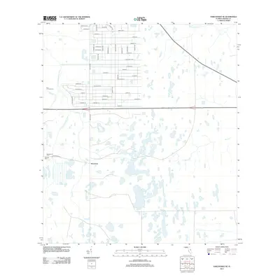
2012 Map of Narcoossee NE
USGS Topo · Published 2012About this map
The Econlockhatchee River and its numerous tributaries, including Little Cr and Fourmile Cr, define this central Florida landscape just east of the growing Orlando area in the early 21st century. The map reveals a striking contrast between the rigid, planned grid of the Wedgefield community in the north and the expansive wetlands to the south. The suburban layout is anchored by major thoroughfares such as Dallas Blvd and Bancroft Blvd, with residential naming conventions like Sodbury St and Peabody St marking the transition from ranch land to residential development.
Find a feature on this map
52 named features on this map. Tap any name to fly to it.
Don’t see what you’re looking for? This feature index may not catch every label — zoom into the map to look around manually.
Map Details
Editions of this 2012 Narcoossee NE Map
This is the sole edition of this map. No revisions or reprints were ever made.
Other maps of this area

1953 · Narcoossee NE
USGS Topo · 1:24,000

1953 · Narcoossee SE
USGS Topo · 1:24,000

1953 · Narcoossee
USGS Topo · 1:24,000

1953 · Lake Poinsett SW
USGS Topo · 1:24,000

1953 · Titusville SW
USGS Topo · 1:24,000

1953 · Oviedo SW
USGS Topo · 1:24,000

1953 · Lake Poinsett NW
USGS Topo · 1:24,000

1953 · Narcoossee NW
USGS Topo · 1:24,000

1953 · Bithlo
USGS Topo · 1:24,000

1955 · Orlando
USGS Topo · 1:250,000