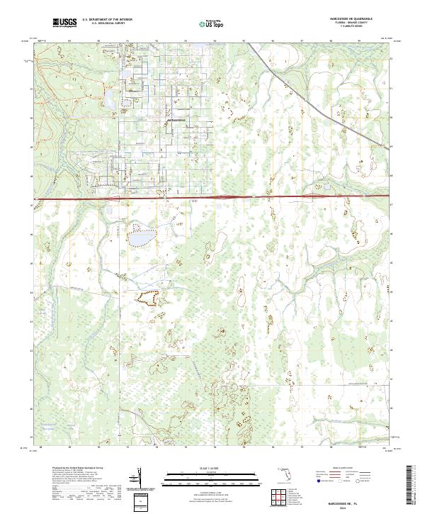
2024 Map of Narcoossee NE
USGS Topo · Published 2024About this map
Wedgefield stands as a primary residential development in this eastern Orange County landscape, organized by an extensive grid of streets like Bancroft Blvd and Dallas Blvd. This organized suburban footprint contrasts sharply with the expansive wetlands to the west and south, dominated by the Econlockhatchee River Swamp and the protected lands of the Hal Scott Regional Preserve and Park Trl. The hydrological network is dense, featuring numerous named waterways such as Turkey Creek Bay, Footloosehatchee Creek, and Sandhill Crane Lake. While the northern section is characterized by a dense residential layout, the southern reaches remain largely undeveloped, defined by natural drainages like Jim Creek and Second Creek, reflecting the modern balance between residential expansion and environmental preservation in central Florida.
Find a feature on this map
63 named features on this map. Tap any name to fly to it.
Don’t see what you’re looking for? This feature index may not catch every label — zoom into the map to look around manually.
Map Details
Editions of this 2024 Narcoossee NE Map
This is the sole edition of this map. No revisions or reprints were ever made.
Other maps of this area

1953 · Narcoossee NE
USGS Topo · 1:24,000

1953 · Narcoossee SE
USGS Topo · 1:24,000

1953 · Narcoossee
USGS Topo · 1:24,000

1953 · Lake Poinsett SW
USGS Topo · 1:24,000

1953 · Titusville SW
USGS Topo · 1:24,000

1953 · Oviedo SW
USGS Topo · 1:24,000

1953 · Lake Poinsett NW
USGS Topo · 1:24,000

1953 · Narcoossee NW
USGS Topo · 1:24,000

1953 · Bithlo
USGS Topo · 1:24,000

1955 · Orlando
USGS Topo · 1:250,000