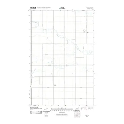
2011 Map of Nash
USGS Topo · Published 2011About this map
Middle Branch Park River and the South Branch Park River carve winding paths across this Walsh County landscape, defining the local geography around the small settlements of Nash and Mandt. The land is organized by a precise grid of rural roads, including 141st Ave Ne and 75th ST Ne, which serve the agricultural plots of the Red River Valley region. Concordia Cemetery stands as a significant genealogical landmark, situated along 143rd Ave Ne south of the river branches. The concentration of development near Nash includes residential naming such as Nash PL and Norchip DR, reflecting the community's modern layout. This survey captures the rural character of the area where County Hwy-6 and County Hwy-11 facilitate local transit through the river-divided terrain.
Find a feature on this map
23 named features on this map. Tap any name to fly to it.
Don’t see what you’re looking for? This feature index may not catch every label — zoom into the map to look around manually.
Map Details
Editions of this 2011 Nash Map
This is the sole edition of this map. No revisions or reprints were ever made.
Other maps of this area

1939 · Glasston
USGS Topo · 1:62,500

1941 · Glasston
USGS Topo · 1:62,500

1943 · Grafton
USGS Topo · 1:62,500

1944 · Crystal
USGS Topo · 1:62,500

1952 · Thief River Falls
USGS Topo · 1:250,000

1956 · Thief River Falls
USGS Topo · 1:250,000

1957 · Thief River Falls
USGS Topo · 1:250,000

1960 · Grafton
USGS Topo · 1:24,000

1963 · Crystal SE
USGS Topo · 1:24,000

1963 · Crystal
USGS Topo · 1:24,000