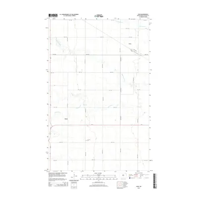
2014 Map of Nash
USGS Topo · Published 2014About this map
The agrarian landscape of Walsh County is defined by the three branches of the Park River as they meander through the Red River Valley. In this 2014 survey, the small community of Nash serves as a local focal point near the northern reaches of the Middle Br Park River. The map details a highly organized section-line road network, including ND-17 and ND-18, which connect isolated farmsteads and rural landmarks. To the southwest, the settlement of Mandt appears along the western edge of the quadrangle. For those researching local heritage, the Concordia Cem stands as a significant genealogical site near the southern crossing of the S Br Park River. The drainage patterns of the N Br Park River and its sister branches illustrate the subtle topography and water management essential to this North Dakota farming region.
Find a feature on this map
27 named features on this map. Tap any name to fly to it.
Don’t see what you’re looking for? This feature index may not catch every label — zoom into the map to look around manually.
Map Details
Editions of this 2014 Nash Map
This is the sole edition of this map. No revisions or reprints were ever made.
Other maps of this area

1939 · Glasston
USGS Topo · 1:62,500

1941 · Glasston
USGS Topo · 1:62,500

1943 · Grafton
USGS Topo · 1:62,500

1944 · Crystal
USGS Topo · 1:62,500

1952 · Thief River Falls
USGS Topo · 1:250,000

1956 · Thief River Falls
USGS Topo · 1:250,000

1957 · Thief River Falls
USGS Topo · 1:250,000

1960 · Grafton
USGS Topo · 1:24,000

1963 · Crystal SE
USGS Topo · 1:24,000

1963 · Crystal
USGS Topo · 1:24,000