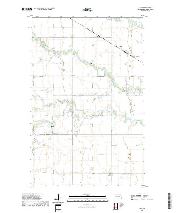
2024 Map of Nash
USGS Topo · Published 2024About this map
Nash serves as a central point of reference in this agricultural landscape of Walsh County, where the terrain is defined by the winding paths of the Middle Branch Park River and the South Branch Park River. The map reveals a dense network of local-history landmarks, particularly several distinct burial grounds that reflect the area's diverse religious heritage. Notable sites include the North Trinity Cem, Zion Cem, and the Mennonite Church Cem, alongside the Concordia Cem and South Trinity Lutheran Cem. A rigid grid of section lines and gravel roads, such as County Highway 11 and Norchip Drive, organizes the vast prairie fields around the watercourses, illustrating the enduring structure of the Public Land Survey System in rural North Dakota.
Find a feature on this map
26 named features on this map. Tap any name to fly to it.
Don’t see what you’re looking for? This feature index may not catch every label — zoom into the map to look around manually.
Map Details
Editions of this 2024 Nash Map
This is the sole edition of this map. No revisions or reprints were ever made.
Other maps of this area

1939 · Glasston
USGS Topo · 1:62,500

1941 · Glasston
USGS Topo · 1:62,500

1943 · Grafton
USGS Topo · 1:62,500

1944 · Crystal
USGS Topo · 1:62,500

1952 · Thief River Falls
USGS Topo · 1:250,000

1956 · Thief River Falls
USGS Topo · 1:250,000

1957 · Thief River Falls
USGS Topo · 1:250,000

1960 · Grafton
USGS Topo · 1:24,000

1963 · Crystal SE
USGS Topo · 1:24,000

1963 · Crystal
USGS Topo · 1:24,000