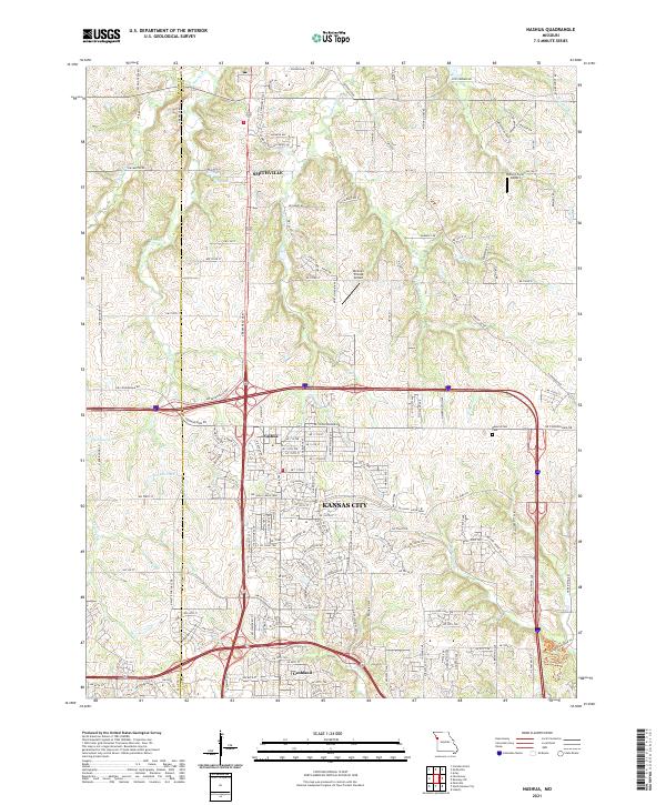
2021 Map of Nashua
USGS Topo · Published 2021About this map
The settlement of Nashua sits at the heart of this contemporary Clay County landscape, where the northern expansion of Kansas City meets the rural transitions near Smithville. This 2021 survey reveals a complex network of residential developments and historical remnants, including Gashland to the south. The terrain is defined by the winding paths of Second Creek and First Creek, which feed into local water bodies such as Sampson Lake and Stevens Lake. Genealogists and local historians can locate long-standing landmarks like Brooks Cemetery in the north and the extensive grounds of Resurrection Cemetery near the county line. The map also documents the modern recreational infrastructure integrated into the landscape, featuring the Hodge Park Ride Trail and Hidden Valley Trail winding through the southeastern hills.
Find a feature on this map
145 named features on this map. Tap any name to fly to it.
Don’t see what you’re looking for? This feature index may not catch every label — zoom into the map to look around manually.
Map Details
Editions of this 2021 Nashua Map
This is the sole edition of this map. No revisions or reprints were ever made.
Other maps of this area

1890 · Kansas City
USGS Topo · 1:125,000

1894 · Kansas City
USGS Topo · 1:125,000

1894 · Independence
USGS Topo · 1:125,000

1914 · Smithville
USGS Topo · 1:62,500

1935 · North Kansas City
USGS Topo · 1:24,000

1935 · Liberty
USGS Topo · 1:24,000

1936 · Kearney
USGS Topo · 1:48,000

1940 · Liberty
USGS Topo · 1:31,680
1940 · North Kansas City
USGS Topo · 1:31,680

1942 · Kearney
USGS Topo · 1:62,500