
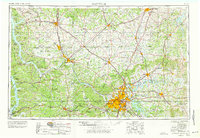
1956 Map of Nashville
USGS Topo · Published 1971About this map
Nashville and the central Tennessee and southern Kentucky borderlands are captured here during a period of significant hydroelectric and military development. The Cumberland River and Tennessee River systems define the geography, shown just as the modern reservoir landscape was maturing. Large-scale water projects like Kentucky Lake, Lake Barkley, and the Percy Priest Reservoir dominate the hydrology, reflecting the mid-century transformation of the region's river-and-rail economy.
Find a feature on this map
96 named features on this map. Tap any name to fly to it.
Don’t see what you’re looking for? This feature index may not catch every label — zoom into the map to look around manually.
Map Details
Editions of this 1956 Nashville Map
2 editions found
Other maps of this area

1893 · Mc Minnville
USGS Topo · 1:125,000

1895 · Mc Minnville
USGS Topo · 1:125,000

1901 · Colombia
USGS Topo · 1:125,000

1903 · Nashville
USGS Topo · 1:125,000

1908 · Woodbury
USGS Topo · 1:62,500

1908 · Princeton
USGS Topo · 1:62,500

1909 · Dawson Springs
USGS Topo · 1:48,000

1909 · Franklin
USGS Topo · 1:62,500

1910 · Princeton
USGS Topo · 1:62,500

1911 · Dawson Springs
USGS Topo · 1:62,500