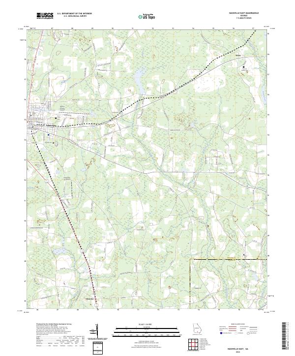
2024 Map of Nashville East
USGS Topo · Published 2024About this map
Nashville serves as the focal point of this South Georgia landscape, where the Berrien County Courthouse stands at the center of a grid including E Marion Ave and N Jackson St. The map illustrates the transition from the concentrated streets of the county seat to the agricultural and wetland expanses defined by Tenmile Creek and Fivemile Creek. Aviation infrastructure is notably prominent for a rural area, with both the Berrien County Airport and the South One Ten Airport situated near the town center.
Find a feature on this map
125 named features on this map. Tap any name to fly to it.
Don’t see what you’re looking for? This feature index may not catch every label — zoom into the map to look around manually.
Map Details
Editions of this 2024 Nashville East Map
This is the sole edition of this map. No revisions or reprints were ever made.
Other maps of this area

1953 · Waycross
USGS Topo · 1:250,000

1958 · Waycross
USGS Topo · 1:250,000

1968 · Lakeland
USGS Topo · 1:24,000

1972 · Tenmile Bay
USGS Topo · 1:24,000

1972 · Willacoochee
USGS Topo · 1:24,000

1973 · New Lois
USGS Topo · 1:24,000

1973 · Sapps Lake
USGS Topo · 1:24,000

1973 · Nashville West
USGS Topo · 1:24,000
1977 · Hastings Fish Pond
USGS Topo · 1:24,000
1978 · Nashville East
USGS Topo · 1:24,000