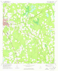
1978 Map of Nashville East
USGS Topo · Published 1978About this map
The town of Nashville serves as a clear focal point in this portion of South Georgia, where a mix of municipal infrastructure and rural agriculture defines the landscape. Urban features like the Courthouse, Hospital, and the Berrien County Airport are concentrated in the west, while the tracks of the Central of Georgia railroad cut across the countryside. The surrounding terrain is heavily influenced by water, featuring the prominent Averys Millpond and Gin Pond, which are fed by the meandering courses of Tenmile Creek and Gin Branch.
Find a feature on this map
34 named features on this map. Tap any name to fly to it.
Don’t see what you’re looking for? This feature index may not catch every label — zoom into the map to look around manually.
Map Details
Editions of this 1978 Nashville East Map
This is the sole edition of this map. No revisions or reprints were ever made.
Other maps of this area

1953 · Waycross
USGS Topo · 1:250,000

1958 · Waycross
USGS Topo · 1:250,000

1968 · Lakeland
USGS Topo · 1:24,000

1972 · Tenmile Bay
USGS Topo · 1:24,000

1972 · Willacoochee
USGS Topo · 1:24,000

1973 · New Lois
USGS Topo · 1:24,000

1973 · Sapps Lake
USGS Topo · 1:24,000

1973 · Nashville West
USGS Topo · 1:24,000
1977 · Hastings Fish Pond
USGS Topo · 1:24,000
1978 · Ray City
USGS Topo · 1:24,000