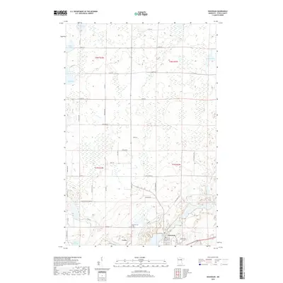
2019 Map of Nashwauk
USGS Topo · Published 2019About this map
Nashwauk and the settlement of Cooley anchor the southern portion of this Itasca County landscape, where the iron-rich terrain of northern Minnesota transitions into a complex network of wetlands and small glacial lakes. The area is defined by its water bodies, from Harrison Lake in the north to the southern reaches of Little Sucker Lake. The local road system, including Country Rd and W Little Sweden Rd, connects scattered rural homesites with the denser street grid of Nashwauk, which contains the Nashwauk Cem. This 2019 survey documents the modern topography of a region historically shaped by mining, with numerous unnamed basins and disturbed landforms appearing alongside established watercourses like O'Brien Cr. The grid-like survey lines of townships such as t58n r22w and t57n r23w overlay a landscape where timber and bog dominate the north, while development remains concentrated along the southern corridor.
Find a feature on this map
45 named features on this map. Tap any name to fly to it.
Don’t see what you’re looking for? This feature index may not catch every label — zoom into the map to look around manually.
Map Details
Editions of this 2019 Nashwauk Map
This is the sole edition of this map. No revisions or reprints were ever made.
Other maps of this area

1919 · Release
USGS Topo · 1:62,500

1920 · Trout Lake
USGS Topo · 1:62,500

1943 · Release
USGS Topo · 1:62,500

1952 · Keewatin
USGS Topo · 1:24,000

1952 · Nashwauk
USGS Topo · 1:24,000

1952 · Silica
USGS Topo · 1:24,000

1952 · Calumet
USGS Topo · 1:24,000

1952 · Pengilly
USGS Topo · 1:24,000

1954 · Hibbing
USGS Topo · 1:250,000

1957 · Hibbing
USGS Topo · 1:250,000