2022 Map of Nashwauk
USGS Topo · Published 2022About this map
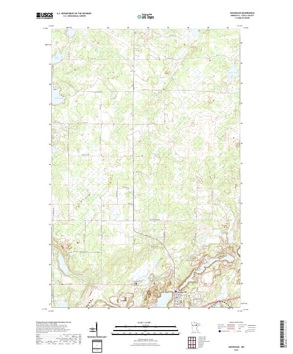
The Mesabi Range defines the southern portion of this landscape, home to the mining community of Nashwauk. This region in Itasca County shows the distinct transition between industrial development and the natural wetlands characteristic of northern Minnesota. To the west, the small settlement of Cooley sits along the southern edge of the map, while the Nashwauk Cem provides a point of interest for genealogists and local historians tracking family roots in the area. North of the town, the terrain becomes a complex network of marshes and forests, accessible by rural routes like N Little Sweden Rd and Co Rd 58. Several water bodies, including Shoal Lake and Shafer Lake, dot the northern sections, with O'Brien Cr draining toward the southeast. The survey details the town's street grid, including Deering Ave E and Platt Ave E, alongside the vast surrounding timber and iron-rich lands.
Find a feature on this map
30 named features on this map. Tap any name to fly to it.
Don’t see what you’re looking for? This feature index may not catch every label — zoom into the map to look around manually.
Map Details
Editions of this 2022 Nashwauk Map
This is the sole edition of this map. No revisions or reprints were ever made.