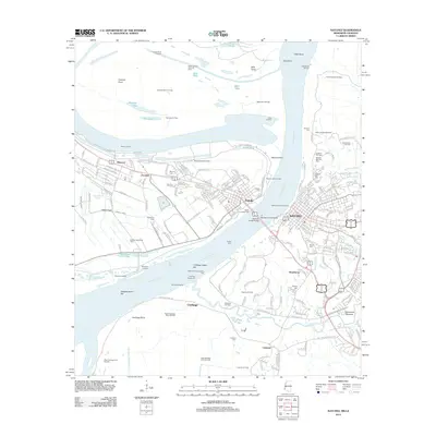
2012 Map of Natchez
USGS Topo · Published 2012About this map
The Mississippi River creates a dynamic border between Louisiana and Mississippi, anchoring the riverfront cities of Vidalia and Natchez. This 2012 landscape is a complex intersection of industry and deep-rooted heritage, where the Natchez-Vidalia Bridge and the Vidalia Ferry span the water to connect the two states. The area's deep history is visible in landmarks like the Fatherland Mounds and the Natchez National Cemetery, alongside several smaller burial grounds such as Minorca Cemetery and Routh Cemetery.
Find a feature on this map
217 named features on this map. Tap any name to fly to it.
Don’t see what you’re looking for? This feature index may not catch every label — zoom into the map to look around manually.
Map Details
Editions of this 2012 Natchez Map
This is the sole edition of this map. No revisions or reprints were ever made.
Other maps of this area

1909 · Sycamore Landing
USGS Topo · 1:24,000

1909 · Vidalia
USGS Topo · 1:24,000

1921 · Natchez
USGS Topo · 1:48,000

1922 · Natchez
USGS Topo · 1:62,500

1939 · Red Gum
USGS Topo · 1:62,500

1939 · Natchez
USGS Topo · 1:62,500

1939 · Kingston
USGS Topo · 1:62,500

1939 · Deer Park
USGS Topo · 1:62,500

1953 · Natchez
USGS Topo · 1:250,000

1956 · Natchez
USGS Topo · 1:250,000