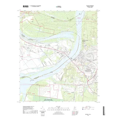
2018 Map of Natchez
USGS Topo · Published 2018About this map
The Mississippi River creates a winding divide between Louisiana and Mississippi, shaping a landscape defined by dramatic bends and shifting alluvial terrain. On the eastern bluffs, Natchez stands as a focal point of regional history, its layout punctuated by significant sites like the Natchez National Cemetery and the Natchez National Historical Park. The connection between the two states is physically anchored by the Natchez-Vidalia Bridge, which links the Mississippi city to Vidalia on the western bank.
Find a feature on this map
197 named features on this map. Tap any name to fly to it.
Don’t see what you’re looking for? This feature index may not catch every label — zoom into the map to look around manually.
Map Details
Editions of this 2018 Natchez Map
This is the sole edition of this map. No revisions or reprints were ever made.
Other maps of this area

1909 · Sycamore Landing
USGS Topo · 1:24,000

1909 · Vidalia
USGS Topo · 1:24,000

1921 · Natchez
USGS Topo · 1:48,000

1922 · Natchez
USGS Topo · 1:62,500

1939 · Red Gum
USGS Topo · 1:62,500

1939 · Natchez
USGS Topo · 1:62,500

1939 · Kingston
USGS Topo · 1:62,500

1939 · Deer Park
USGS Topo · 1:62,500

1953 · Natchez
USGS Topo · 1:250,000

1956 · Natchez
USGS Topo · 1:250,000