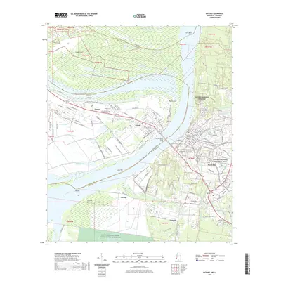
2020 Map of Natchez
USGS Topo · Published 2020About this map
The Mississippi River carves a complex path between Adams County and Concordia Parish, defining the historic twin cities of Natchez and Vidalia. On the eastern bluffs, the Natchez National Historical Park and the sprawling Natchez National Cemetery overlook the water, while the western bank features the organized grid of Vidalia and the outlying community of Minorca. The landscape is shaped by the river's hydrological power, evidenced by features like Giles Cutoff and Giles Bend, alongside numerous oxbow remnants and bayous such as Spanish Bayou and Cemetery Bayou.
Find a feature on this map
194 named features on this map. Tap any name to fly to it.
Don’t see what you’re looking for? This feature index may not catch every label — zoom into the map to look around manually.
Map Details
Editions of this 2020 Natchez Map
This is the sole edition of this map. No revisions or reprints were ever made.
Other maps of this area

1909 · Sycamore Landing
USGS Topo · 1:24,000

1909 · Vidalia
USGS Topo · 1:24,000

1921 · Natchez
USGS Topo · 1:48,000

1922 · Natchez
USGS Topo · 1:62,500

1939 · Red Gum
USGS Topo · 1:62,500

1939 · Natchez
USGS Topo · 1:62,500

1939 · Kingston
USGS Topo · 1:62,500

1939 · Deer Park
USGS Topo · 1:62,500

1953 · Natchez
USGS Topo · 1:250,000

1956 · Natchez
USGS Topo · 1:250,000