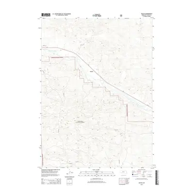
2014 Map of Natick
USGS Topo · Published 2014About this map
The Middle Loup River snakes through the Sandhills of Thomas County, carving a narrow valley through the high, undulating dunes of central Nebraska. This landscape is dominated by the Nebraska National Forest, an unconventional woodland established in the early 20th century as part of an effort to create a timber resource in the treeless Great Plains. The small settlement of Natick sits along the Ne-2 highway and the adjacent rail corridor, which both follow the gentle gradient of the river valley. Local travel is facilitated by a network of rural routes including Gaston Rd and Nantick Rd, which navigate the complex topography of the surrounding dunes. The map illustrates the specific boundary where the forest's hand-planted pines meet the natural prairie grasses, a transition that has defined the region's conservation and land-use history for over a century.
Find a feature on this map
9 named features on this map. Tap any name to fly to it.
Don’t see what you’re looking for? This feature index may not catch every label — zoom into the map to look around manually.
Map Details
Editions of this 2014 Natick Map
This is the sole edition of this map. No revisions or reprints were ever made.
Other maps of this area

1948 · Thedford
USGS Topo · 1:62,500

1948 · Halsey
USGS Topo · 1:62,500

1948 · Seneca 4
USGS Topo · 1:62,500

1949 · Seneca 4
USGS Topo · 1:62,500

1949 · Purdum
USGS Topo · 1:62,500

1950 · Thedford
USGS Topo · 1:62,500

1950 · Halsey
USGS Topo · 1:62,500

1951 · Purdum
USGS Topo · 1:62,500

1954 · North Platte
USGS Topo · 1:250,000

1956 · North Platte
USGS Topo · 1:250,000