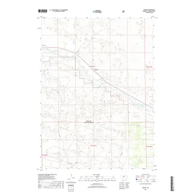
2017 Map of Natick
USGS Topo · Published 2017About this map
Natick serves as the central point of reference in this Thomas County landscape, situated where the high plains terrain meets the valley of the Middle Loup River. The river winds diagonally across the quadrangle, creating a distinct hydrological corridor through the surrounding hills. To the south, the boundary of the Nebraska National Forest marks a significant transition in land management and preservation within the Sandhills region. A network of rural routes, including Mc Mullan Ave, Gaston Rd, and Natick Rd, provides access to the interior sections and highlights the rectilinear surveying patterns of the township and range system. This 2017 survey by the U.S. Geological Survey captures the quiet character of western Nebraska, where the sparse settlement of Natick remains tied to the water and the vast grazing lands of the forest.
Find a feature on this map
13 named features on this map. Tap any name to fly to it.
Don’t see what you’re looking for? This feature index may not catch every label — zoom into the map to look around manually.
Map Details
Editions of this 2017 Natick Map
This is the sole edition of this map. No revisions or reprints were ever made.
Other maps of this area

1948 · Thedford
USGS Topo · 1:62,500

1948 · Halsey
USGS Topo · 1:62,500

1948 · Seneca 4
USGS Topo · 1:62,500

1949 · Seneca 4
USGS Topo · 1:62,500

1949 · Purdum
USGS Topo · 1:62,500

1950 · Thedford
USGS Topo · 1:62,500

1950 · Halsey
USGS Topo · 1:62,500

1951 · Purdum
USGS Topo · 1:62,500

1954 · North Platte
USGS Topo · 1:250,000

1956 · North Platte
USGS Topo · 1:250,000