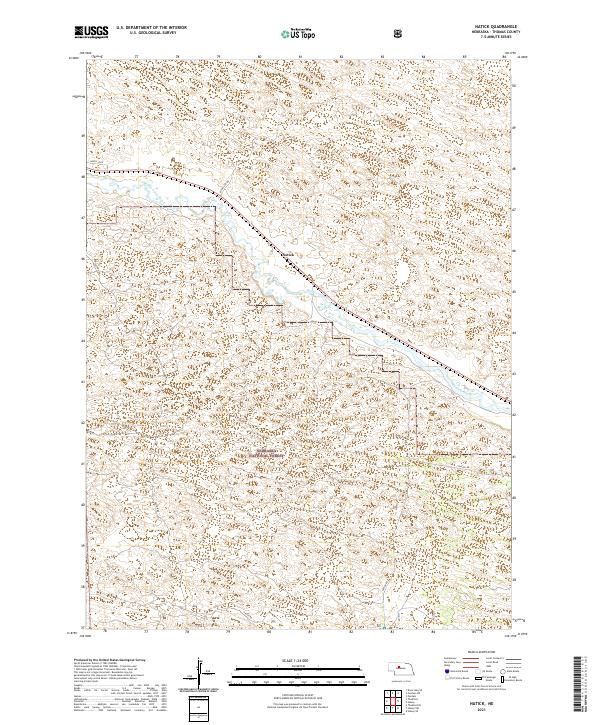
2021 Map of Natick
USGS Topo · Published 2021About this map
The Middle Loup River winds through this section of the Nebraska Sandhills, providing a stark hydrological contrast to the surrounding undulating terrain. This landscape is defined by the settlement of Natick and the northern boundary of the Nebraska National Forest, an area notable for being one of the largest hand-planted forests in the United States. The map traces a network of rural routes including McMillan Ave and Natick Rd, which serve the isolated ranching and conservation lands in Thomas County. The terrain is dominated by complex dune formations and depressions, characteristic of the region's unique geography, while the river valley serves as the primary corridor for movement and development. Local roads like Koroy Loop and Circle Rd provide access to the interior of the high plains, where the vastness of the public forest lands meets private holdings.
Find a feature on this map
13 named features on this map. Tap any name to fly to it.
Don’t see what you’re looking for? This feature index may not catch every label — zoom into the map to look around manually.
Map Details
Editions of this 2021 Natick Map
This is the sole edition of this map. No revisions or reprints were ever made.
Other maps of this area

1948 · Thedford
USGS Topo · 1:62,500

1948 · Halsey
USGS Topo · 1:62,500

1948 · Seneca 4
USGS Topo · 1:62,500

1949 · Seneca 4
USGS Topo · 1:62,500

1949 · Purdum
USGS Topo · 1:62,500

1950 · Thedford
USGS Topo · 1:62,500

1950 · Halsey
USGS Topo · 1:62,500

1951 · Purdum
USGS Topo · 1:62,500

1954 · North Platte
USGS Topo · 1:250,000

1956 · North Platte
USGS Topo · 1:250,000