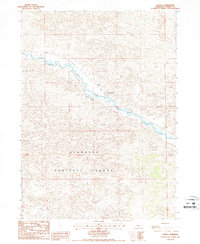
1986 Map of Natick
USGS Topo · Published 1987About this map
The Middle Loup River winds through the heart of this central Nebraska landscape, defining the topography of the Sandhills region in the mid-1980s. The Burlington Northern railroad corridor parallels the river valley, serving as a vital transportation artery through this sparsely populated terrain. Small settlements and local landmarks like Natick and Nutter Ranch provide evidence of the ranching and rail-oriented economy of Thomas County. South of the river, a portion of the Nebraska National Forest encompasses the rolling hills, showcasing the unique managed forestry efforts within this grassland environment. This provisional survey captures the intersection of natural watercourses, commercial rail infrastructure, and public land management in the High Plains.
Find a feature on this map
6 named features on this map. Tap any name to fly to it.
Don’t see what you’re looking for? This feature index may not catch every label — zoom into the map to look around manually.
Map Details
Editions of this 1986 Natick Map
This is the sole edition of this map. No revisions or reprints were ever made.
Other maps of this area

1948 · Thedford
USGS Topo · 1:62,500

1948 · Halsey
USGS Topo · 1:62,500

1948 · Seneca 4
USGS Topo · 1:62,500

1949 · Seneca 4
USGS Topo · 1:62,500

1949 · Purdum
USGS Topo · 1:62,500

1950 · Thedford
USGS Topo · 1:62,500

1950 · Halsey
USGS Topo · 1:62,500

1951 · Purdum
USGS Topo · 1:62,500

1954 · North Platte
USGS Topo · 1:250,000

1956 · North Platte
USGS Topo · 1:250,000