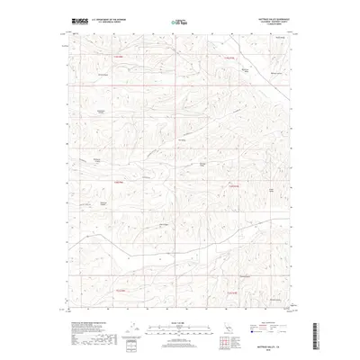
2018 Map of Nattrass Valley
USGS Topo · Published 2018About this map
Nattrass Valley and the surrounding high country of the Diablo Range define this portion of Monterey County. The landscape is carved by deep drainages, including Wildhorse Canyon and Spring Canyon, which descend toward the seasonally flowing San Lorenzo Cr in the northeast. This 2018 survey reveals a terrain dominated by ranching and natural watersheds rather than dense urban development, where transit is restricted to narrow routes like Wildhorse Rd and Hamilton Canyon Rd. The distribution of named features like Peachtree Valley and Green Valley highlights the pockets of lower-elevation land where agriculture and settlement are most viable amidst the steep slopes. Genealogists and local historians can use these topographic details to pinpoint the family-named landmarks and rural roads that have served as the framework for life in this part of California for generations.
Find a feature on this map
25 named features on this map. Tap any name to fly to it.
Don’t see what you’re looking for? This feature index may not catch every label — zoom into the map to look around manually.
Map Details
Editions of this 2018 Nattrass Valley Map
This is the sole edition of this map. No revisions or reprints were ever made.
Other maps of this area

1912 · San Ardo
USGS Topo · 1:31,680

1915 · Priest Valley
USGS Topo · 1:125,000

1919 · King City
USGS Topo · 1:62,500

1921 · Metz
USGS Topo · 1:62,500

1939 · King City
USGS Topo · 1:62,500

1940 · Metz
USGS Topo · 1:62,500

1941 · San Ardo
USGS Topo · 1:62,500

1943 · San Ardo
USGS Topo · 1:62,500

1943 · Hernandez Valley
USGS Topo · 1:62,500

1944 · Hernandez Valley
USGS Topo · 1:62,500