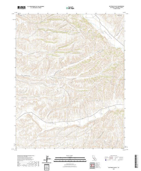
2021 Map of Nattrass Valley
USGS Topo · Published 2021About this map
Nattrass Valley and the surrounding drainages of the southern Diablo Range define this landscape within Monterey County. The area is characterized by a dense network of seasonal watercourses and deeply etched canyons, including Sweetwater Canyon, Hamilton Canyon, and Wildhorse Canyon. Transportation in this rural corridor is primarily facilitated by Wildhorse Rd and Hamilton Canyon Rd, which thread through the valley floors and ridges. Along the eastern edge of the quadrangle, Peachtree Valley and Green Valley run parallel to the mountain range, while San Lorenzo Cr drains the northern reaches. This 2021 survey illustrates a modern pattern of large-scale land divisions and remote access routes typical of the California interior ranges, where water management and topographical constraints dictate the movement through Long Valley and toward the headwaters of Pine Cr.
Find a feature on this map
26 named features on this map. Tap any name to fly to it.
Don’t see what you’re looking for? This feature index may not catch every label — zoom into the map to look around manually.
Map Details
Editions of this 2021 Nattrass Valley Map
This is the sole edition of this map. No revisions or reprints were ever made.
Other maps of this area

1912 · San Ardo
USGS Topo · 1:31,680

1915 · Priest Valley
USGS Topo · 1:125,000

1919 · King City
USGS Topo · 1:62,500

1921 · Metz
USGS Topo · 1:62,500

1939 · King City
USGS Topo · 1:62,500

1940 · Metz
USGS Topo · 1:62,500

1941 · San Ardo
USGS Topo · 1:62,500

1943 · San Ardo
USGS Topo · 1:62,500

1943 · Hernandez Valley
USGS Topo · 1:62,500

1944 · Hernandez Valley
USGS Topo · 1:62,500