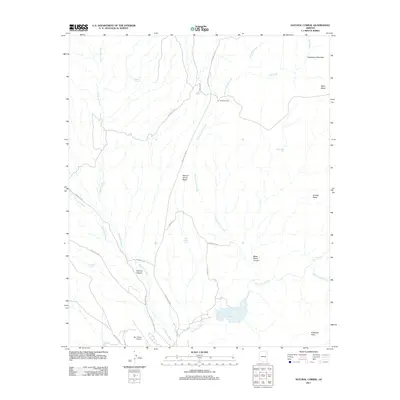
2011 Map of Natural Corral
USGS Topo · Published 2011About this map
San Carlos River flows through the southern portion of this landscape, feeding into Lake Takalai near the Antelope Flats. This 2011 survey reveals a high-desert environment defined by significant topographic relief and an extensive network of ephemeral waterways. Large elevated landforms like Black Mesa, Sontag Mesa, and Natural Corral Mesa dominate the horizon, separated by deep incisions such as Black Mesa Canyon and Dourine Canyon.
Find a feature on this map
32 named features on this map. Tap any name to fly to it.
Don’t see what you’re looking for? This feature index may not catch every label — zoom into the map to look around manually.
Map Details
Editions of this 2011 Natural Corral Map
This is the sole edition of this map. No revisions or reprints were ever made.
Other maps of this area

1922 · Chrysotile
USGS Topo · 1:125,000

1954 · Mesa
USGS Topo · 1:250,000

1957 · Mesa
USGS Topo · 1:250,000

1958 · Mesa
USGS Topo · 1:250,000

1960 · Mesa
USGS Topo · 1:250,000

1964 · Mesa
USGS Topo · 1:250,000

1965 · Sontag Mesa
USGS Topo · 1:24,000

1965 · Bucket Mtn
USGS Topo · 1:24,000

1966 · Natural Corral
USGS Topo · 1:24,000
1966 · Dourine Canyon
USGS Topo · 1:24,000