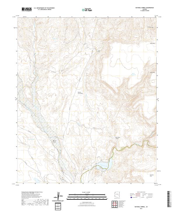
2021 Map of Natural Corral
USGS Topo · Published 2021About this map
San Carlos River and the Blue River converge in this high-desert landscape, defining a region characterized by dramatic elevation changes and named landforms. To the north, Cassadore Mtn and the broad plateau of Black Mesa overlook the titular Natural Corral, where local hydrology is marked by scattered livestock or wildlife watering points like Holdup Tank and Agency Tank. The map reveals a complex network of Bureau of Indian Affairs (BIA) routes, including Bia RD 1100 and Bia RD 920, which provide access through the deep incisions of Dourine Canyon and across the level expanse of Antelope Flats. This 2021 survey illustrates a landscape primarily shaped by its drainage patterns and mesa topography, with the Gila Co Graham Co boundary line cutting through the river valley southeast of Natural Corral Mesa.
Find a feature on this map
38 named features on this map. Tap any name to fly to it.
Don’t see what you’re looking for? This feature index may not catch every label — zoom into the map to look around manually.
Map Details
Editions of this 2021 Natural Corral Map
This is the sole edition of this map. No revisions or reprints were ever made.
Other maps of this area

1922 · Chrysotile
USGS Topo · 1:125,000

1954 · Mesa
USGS Topo · 1:250,000

1957 · Mesa
USGS Topo · 1:250,000

1958 · Mesa
USGS Topo · 1:250,000

1960 · Mesa
USGS Topo · 1:250,000

1964 · Mesa
USGS Topo · 1:250,000

1965 · Sontag Mesa
USGS Topo · 1:24,000

1965 · Bucket Mtn
USGS Topo · 1:24,000

1966 · Natural Corral
USGS Topo · 1:24,000
1966 · Dourine Canyon
USGS Topo · 1:24,000