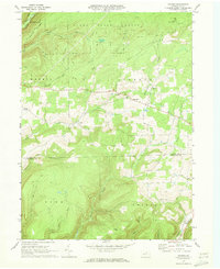
1969 Map of Nauvoo
USGS Topo · Published 1973About this map
Nauvoo and Hartfield anchor this rural landscape along the northern edge of the Tioga Co Lycoming Co line, where the terrain is defined by deep hollows and narrow ridges. Much of the northern portion is occupied by the Tioga State Forest, featuring landforms such as Hickory Ridge and watercourses like Long Run. The settlement pattern follows the creek valleys and the Custard Road corridor, with local landmarks like Beuters Ch and Salem Ch serving the community.
Find a feature on this map
28 named features on this map. Tap any name to fly to it.
Don’t see what you’re looking for? This feature index may not catch every label — zoom into the map to look around manually.
Map Details
Editions of this 1969 Nauvoo Map
3 editions found
Other maps of this area

1921 · Trout Run
USGS Topo · 1:62,500

1923 · Trout Run
USGS Topo · 1:62,500

1925 · Blossburg
USGS Topo · 1:62,500

1927 · Blossburg
USGS Topo · 1:62,500

1937 · Waterville
USGS Topo · 1:48,000

1943 · Waterville
USGS Topo · 1:62,500

1944 · Blossburg
USGS Topo · 1:62,500

1944 · Trout Run
USGS Topo · 1:62,500

1946 · Antrim
USGS Topo · 1:62,500

1946 · Antrim
USGS Topo · 1:24,000