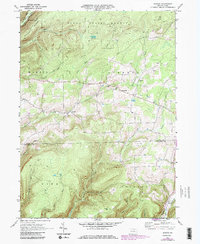
1969 Map of Nauvoo
USGS Topo · Published 1986About this map
Tioga State Forest dominates the northern reaches of this map, where the terrain is carved by Long Run and Little Fall Creek. The topography is defined by prominent elevations such as Hickory Ridge and Sugar Hill, while the human footprint is concentrated along the creek valleys. The small settlement of Nauvoo serves as a central point, surrounded by rural clusters like Hartfield and Beuters Cor. Local history is anchored by the Salem Ch and its accompanying Salem Ch Cem, reflecting the early community life of the region.
Find a feature on this map
31 named features on this map. Tap any name to fly to it.
Don’t see what you’re looking for? This feature index may not catch every label — zoom into the map to look around manually.
Map Details
Editions of this 1969 Nauvoo Map
3 editions found
Other maps of this area

1921 · Trout Run
USGS Topo · 1:62,500

1923 · Trout Run
USGS Topo · 1:62,500

1925 · Blossburg
USGS Topo · 1:62,500

1927 · Blossburg
USGS Topo · 1:62,500

1937 · Waterville
USGS Topo · 1:48,000

1943 · Waterville
USGS Topo · 1:62,500

1944 · Blossburg
USGS Topo · 1:62,500

1944 · Trout Run
USGS Topo · 1:62,500

1946 · Antrim
USGS Topo · 1:62,500

1946 · Antrim
USGS Topo · 1:24,000