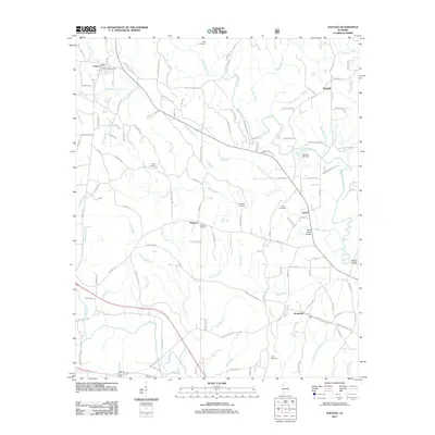
2011 Map of Nauvoo
USGS Topo · Published 2011About this map
Nauvoo and its Nauvoo Post Office serve as the primary northern hub in this detailed survey of rural Walker County. The landscape is defined by an intricate network of waterways including Blackwater Creek, Buck Creek, and the Bean River, which historically dictated the placement of small communities like Saragossa, Lupton, and Rosehill. Local family history is well-preserved through numerous burial sites, including the King Cemetery, Keeton Cemetery, and Ferguson Cemetery. One of the most distinctive markers of the area's physical history is the Odums Mill Dam located on a bend of Blackwater Creek, illustrating the enduring relationship between the local economy and its water resources. This survey maps the transition of the region's transport from historical creek crossings, such as Staggs Bridge, to the modern road network comprising Slicklizzard Rd and Romine Bailey Rd.
Find a feature on this map
123 named features on this map. Tap any name to fly to it.
Don’t see what you’re looking for? This feature index may not catch every label — zoom into the map to look around manually.
Map Details
Editions of this 2011 Nauvoo Map
This is the sole edition of this map. No revisions or reprints were ever made.
Other maps of this area

1893 · Jasper
USGS Topo · 1:125,000

1949 · Townley
USGS Topo · 1:24,000

1949 · Jasper
USGS Topo · 1:24,000

1949 · Manchester
USGS Topo · 1:24,000

1949 · Nauvoo
USGS Topo · 1:24,000

1950 · Nauvoo
USGS Topo · 1:24,000

1950 · Manchester
USGS Topo · 1:24,000

1951 · Jasper
USGS Topo · 1:24,000

1951 · Townley
USGS Topo · 1:24,000

1953 · Birmingham
USGS Topo · 1:250,000