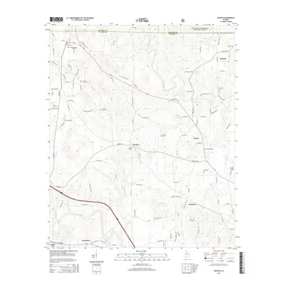
2014 Map of Nauvoo
USGS Topo · Published 2014About this map
Nauvoo and Saragossa anchor this landscape along the Winston Co Walker Co border, where the southern reaches of the William B. Bankhead National Forest meet a network of creek bottoms and small settlements. The topography is defined by the winding course of Blackwater Creek and its many tributaries, including Buck Cr and Lost Creek. Traces of local history are preserved in numerous family and community burial grounds such as Liberty Grove Cem and Fergerson Cem, while Mt Herman Church and the waters of Odums Mill Pond mark long-standing rural gathering points. The map details the transition from the forested northern uplands to the southern hills near Carbon Hill, connected by routes like Al-5 and structures like Buck Creek Bridge and Staggs Bridge that span the region's complex drainage system.
Find a feature on this map
125 named features on this map. Tap any name to fly to it.
Don’t see what you’re looking for? This feature index may not catch every label — zoom into the map to look around manually.
Map Details
Editions of this 2014 Nauvoo Map
This is the sole edition of this map. No revisions or reprints were ever made.
Other maps of this area

1893 · Jasper
USGS Topo · 1:125,000

1949 · Townley
USGS Topo · 1:24,000

1949 · Jasper
USGS Topo · 1:24,000

1949 · Manchester
USGS Topo · 1:24,000

1949 · Nauvoo
USGS Topo · 1:24,000

1950 · Nauvoo
USGS Topo · 1:24,000

1950 · Manchester
USGS Topo · 1:24,000

1951 · Jasper
USGS Topo · 1:24,000

1951 · Townley
USGS Topo · 1:24,000

1953 · Birmingham
USGS Topo · 1:250,000